 vesseltracker.com
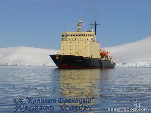
Vessel KAPITAN DRANITSYN IMO: 7824405, MMSI: 273138300 Icebreaker
UTC, 56.35848, 138.31035, course: 35, speed: 9.5
UTC, 56.58171, 138.57945, course: 35, speed: 10.5
2026-02-21 21:40:00 UTC, 56.74115, 139.14325, course: 113, speed: 8.7
Live AIS position:
UTC. 202 nm SW of Okhotsk),
updated 2026-02-21 21:40:00 UTC.
Find the position of the vessel KAPITAN DRANITSYN on the map. The latter are known coordinates and path.
marine traffic ship tracker show on live map
The current position of vessel KAPITAN DRANITSYN is 56.74115 lat / 139.14325 lng. Updated: 2026-02-21 21:40:00 UTCCurrently sailing under the flag of Russia
KAPITAN DRANITSYN built in 1980 year
Deadweight:
4515 tDetails:
Last coordinates of the vessel:
UTC, 56.15161, 137.97267, course: 46, speed: 9UTC, 56.35848, 138.31035, course: 35, speed: 9.5
UTC, 56.58171, 138.57945, course: 35, speed: 10.5
2026-02-21 21:40:00 UTC, 56.74115, 139.14325, course: 113, speed: 8.7